Last year over 700 boat owners who have non-trailered boats moored in marinas around Aotearoa…
Data from New Zealand’s largest recreational vessel survey are in!
Our programme’s recreational vessel survey, undertaken by the MANAGE & RESPOND team and led by Deakin University and Cawthron PhD student Kyle Hilliam, ran over the NZ summer and closed in March. We received over 1,800 individual responses from throughout the country. To our knowledge, they represent the largest recreational vessel movement dataset ever collected.
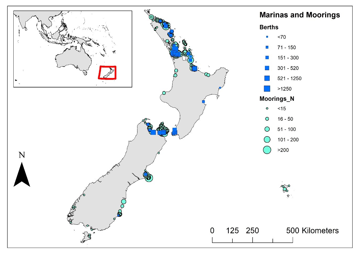
Recreational vessel ‘homeports’ around New Zealand. The size of blue squares and green circles depict the numbers of marina berths and coastal moorings around coastal areas, respectively.
Not surprisingly, most of the respondents were from NZ’s sailing centres, particularly Auckland, Northland, Bay of Plenty, Wellington and Marlborough. The level of responses from each region corresponds well to the number of marina berths and moorings they each have, meaning that the data collected is reasonably representative of the domestic recreational vessel community.
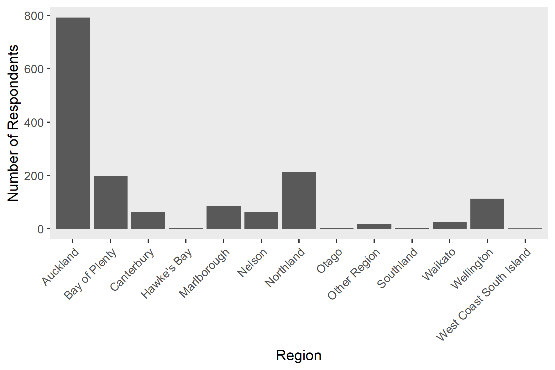
Survey responses for regions within New Zealand.
The survey respondents provided information on the timing and duration of their visits to over 12,000 coastal destinations nationwide. Whilst a lot of these places are known destinations for recreational vessels, the survey data will yield important information on many other, less popular destinations, including those in marine protected areas and other high-value environments. Importantly, our data contains information on multi-destination voyages and their timing, enabling us to understand how coastal destinations are connected to one another via vessel movements and seasonal variations in boating activity. Ultimately this data will be used to create a recreational vessel network with relative movements between destinations.
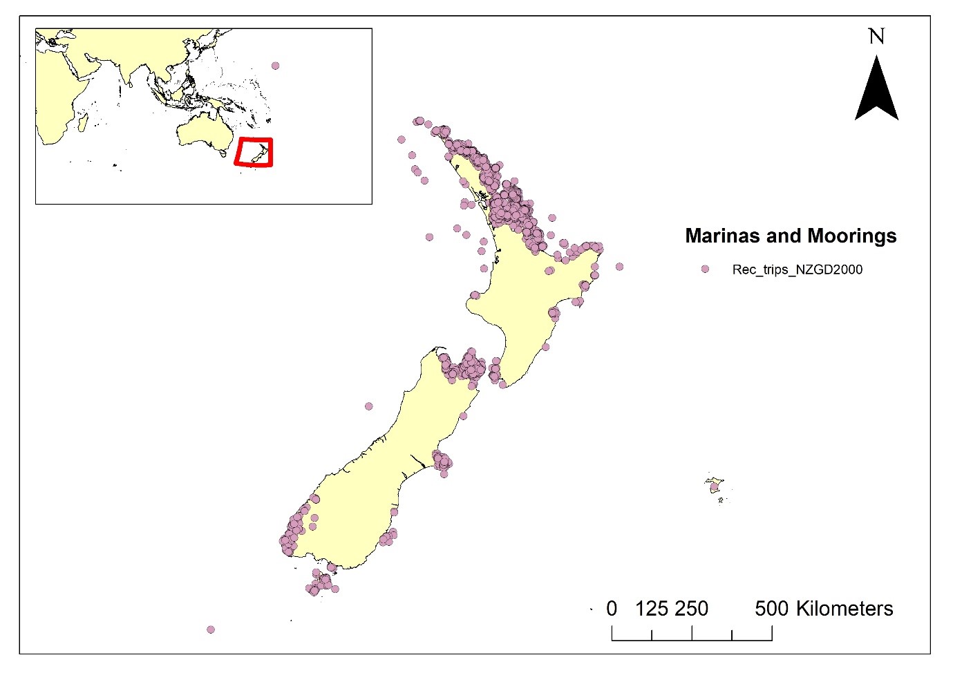
The destinations (pink circles) received from survey respondents. It is impossible to see all 12,000 logged visits, but this map conveys the nationwide coverage of our data.

The diversity of vessel destinations logged, using the Hauraki Gulf as an example.
We look forward to exploring and analysing this dataset and comparing it to the parallel assimilation of similar information on commercial shipping and aquaculture industry movements. Together, these will be used to develop the first-ever multi-sector maritime network model, a tool intended to support marine biosecurity management, spatial planning and conservation. More updates to come!
Finally, a big thank-you again to our research partners and supporters, Yachting New Zealand and the New Zealand Marina Operators Association!

Your post emphasizes the importance of maintaining a positive mindset and perseverance when facing challenges in making money. It’s a reminder to stay resilient. For more details, click here.